Let's talk Web GIS and interactive mapping
Introducing the concept of web-based GIS applications and demonstrating how to create interactive maps using ArcGIS online by our GIS Officer, David Mitchell.
Introduction
So far, I have mainly introduced the capabilities of GIS within a desktop context but one of the major advantages of GIS is its ability to link with an online environment. This allows for easier sharing of data between users even without a GIS system of their own and open up a world of applications such as interactive web maps, web apps, dashboards and storyboards.
What is ArcGIS Online?
ArcGIS Online is a cloud-based form of GIS data storage that allows you to share and store your data online. This means that any data which you or your company have and want to share with clients, or the public, can be published to the online environment with relative ease.
What can ArcGIS Online do?
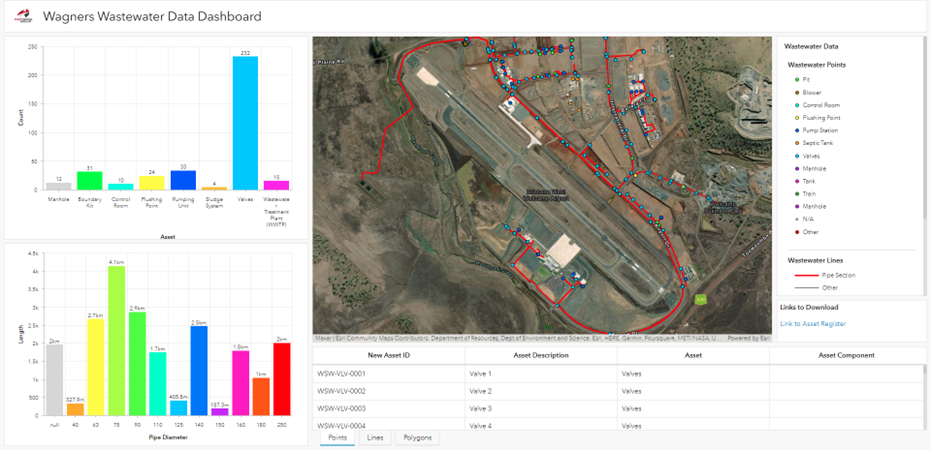
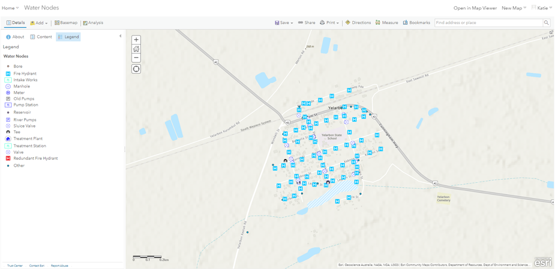
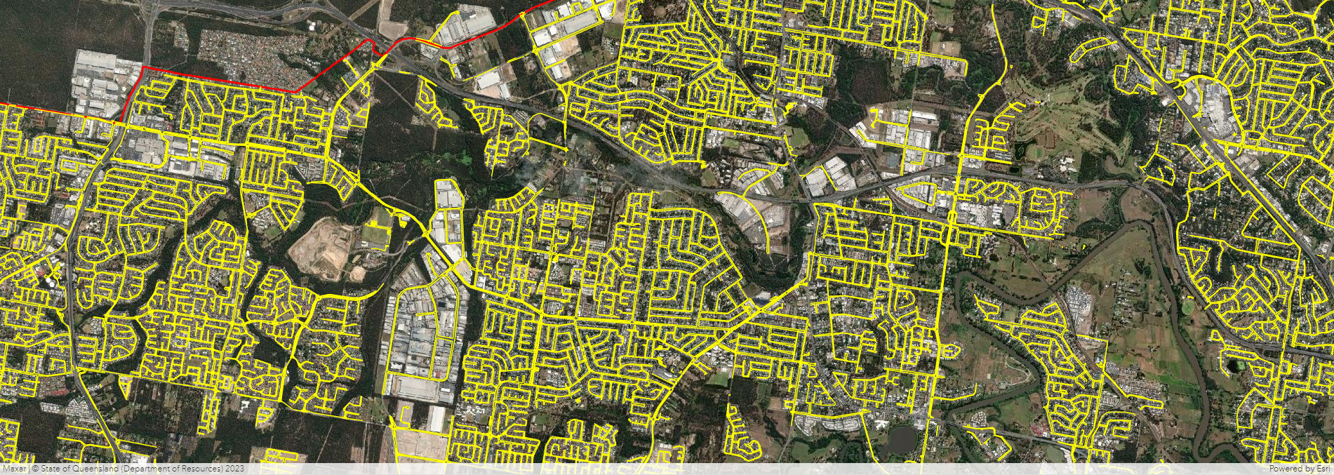
While the ability to store and share your data on the internet is a mainstay of ArcGIS the main advantage of it is the applications. These applications include the ability to make web maps, web apps, dashboards, storyboards, field applications and experience builders. As mentioned previously, maps are a good way to convey data to people so using the internet to make a map shareable and interactive with your own data opens up a world of possibilities of what you can do with your data. It allows you to do measurements, layer data, change basemaps, search data and visualise real time captured data.
What are the benefits of Web GIS?
The main benefit of an organisation embracing web GIS is the increased ability to share data amongst and across organisations. The online ArcGIS environment lends itself to becoming a vast repository of spatial data which benefits both GIS and non-GIS users alike increasing spatial literacy and leading to better informed solutions and outcomes.
If you'd like to chat all things GIS, complete our contact form below or reach out to David at David.Mitchell@proterragroup.com.au