So what does a GIS Officer actually do?
An explanation of the basic concepts, components and applications of Geographic Information Systems by our GIS Officer, David Mitchell.
Introduction
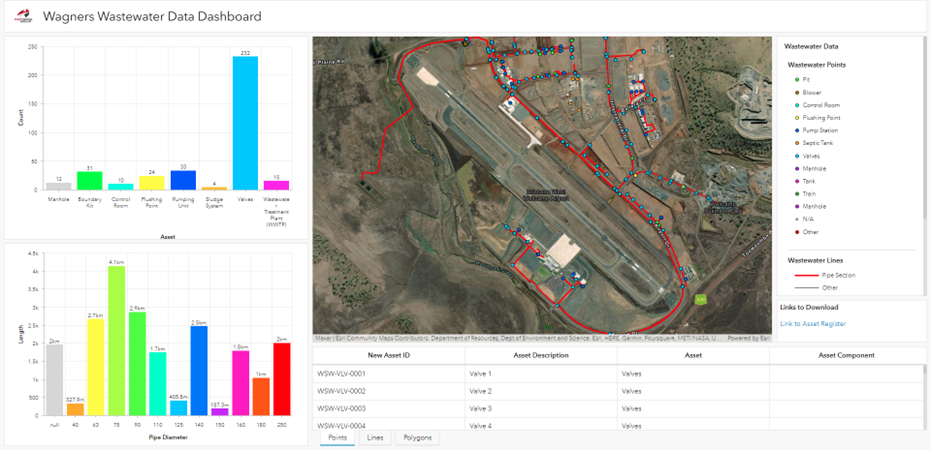
As a GIS Officer I often get asked the question, “What do you actually do?” to which I usually reply with something along the lines of mapping, data or even surveying (which it isn’t) while I watch their eyes begin to glaze over. I often feel like I don’t quite give justice to the vast world of applications and industries that GIS has and can be used in. I develop everything from informative dashboards to field data capture applications to web mapping and data portal and yes, the humble map.
What is GIS?
GIS is a system that creates, manages, analyses and maps data of many formats. That is the foundation that underpins a successful Geographic Information System, data.
It is the system that integrates locational data (where something is, known as spatial data) with what it is and information about that data (known as attribute data). From here that data can be analysed for trends/patterns and mapped/visualised in many tailored ways dependent on specific needs.
Why is GIS Important?
GIS is important for a number of reasons across a number of industries and applications. It can identify problems, monitor change, understand trends in data, present data easily to different audiences and help manage and respond to events.
It allows us to make informed decisions based on relevant and accurate spatial data that just can’t be seen as easily in spreadsheets and sets of numbers. An extensive and accurate GIS system can help to save money and increase efficiency in all areas of a local government area from infrastructure planning to environmental services and even community services.
Learn More
To learn more about real-world application of GIS, check out our project highlights page. Some of our most recent projects include:
- Wagner's Business Park (WBP) Asset Management Services: Development of an encompassing asset register for the Wagners Business Park using GIS to create many features such as accurate data, dashboards and a data portal for their GIS data.
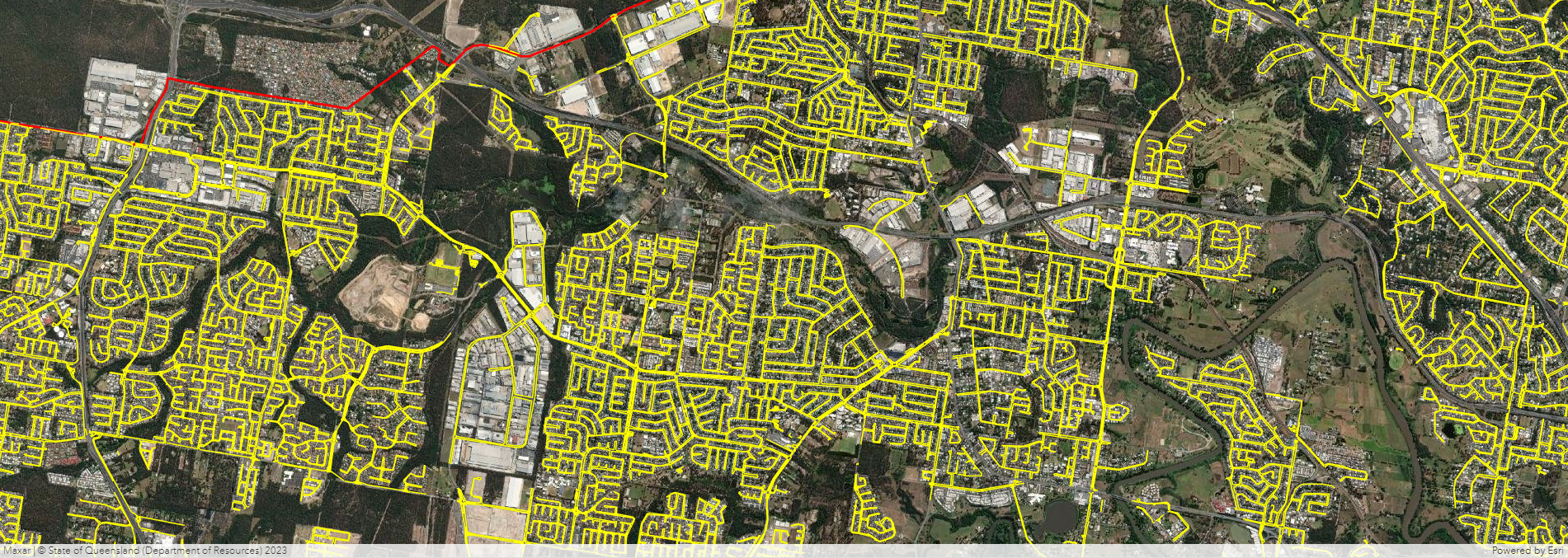
- Logan City Council Kerb & Channel Asset Mapping: Creation of a comprehensive and accurate kerb, channel, median and roundabout dataset using high level spatial analysis techniques including joins, creating routes and automation.
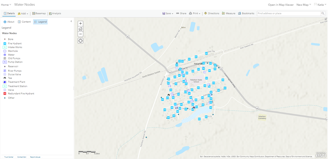
- Goondiwindi Regional Council Asset Management & GIS Services: Cleansing and creating accurate spatial asset registers within a web mapping/online environment.
If you'd like to chat all things GIS, complete our contact form below or reach out to David at David.Mitchell@proterragroup.com.au